
By: Sarah Mayher (5/20/2018)
Ever visit a place for the opposite reason the average person does? (Habitat for Humanity in New Orleans during Mardi Gras? Layover in the city hosting the Superbowl? Atheist tourist in a Holy City during Holy Week?) It’s a similar experience when you vacation to Las Vegas with plans to “get away” and enjoy the great outdoors. Like all good showmen, Vegas hides its best tricks and sights out of the way, where crowds haven’t the cohesion or willpower to accumulate and cheapen the experience. More than neon lights and dim casino catacombs, Vegas has a backstory, a natural history, a vast, surrounding desert birthplace, offering endless opportunity to explore, contemplate, and wonder.
Las Vegas serves as an ideal trail head for many bucket-list pursuits located in the American Southwest.
Within minutes of arriving, you will be accosted with offerings of helicopter and bus tours to the Grand Canyon – about 4 hours east by car. Death Valley to the west and Zion National Park to the northeast are even closer, both about a 2.5-hour drive, and you will officially enter the Mojave Desert National Preserve within an hour of traveling south.
Affordability is another perk of starting your adventure in Vegas. Many discount airlines offer cheap non-stop flights to the city. I flew Allegiant from Cincinnati at 9 pm on a Friday and was able to forgo baggage expenses since others in my family had driven in with our gear.
My travel companions for the trip were my parents (who road tripped from eastern Ohio), and my sister, who arrived the next day (Saturday) from Pittsburgh. By 1pm, just over 12 hours since my arrival in Sin City, our little SUV was fleeing south on Interstate 15 to the land of the peculiar and bizarrely beautiful Joshua Tree.
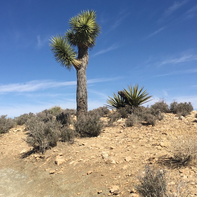
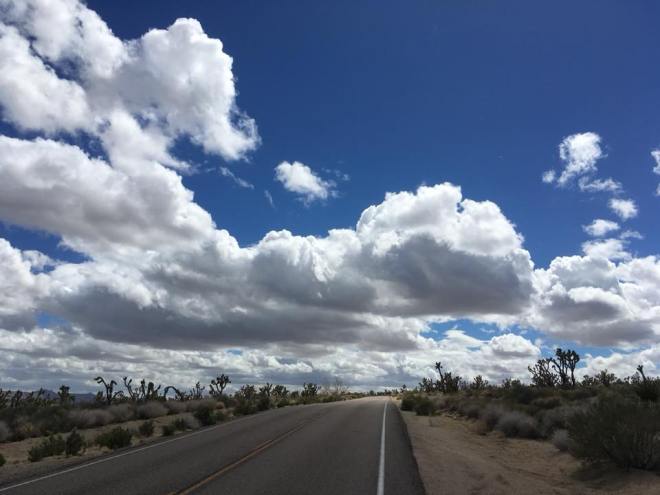
Joshua Trees (Yucca brevifolia) are scraggly but determined creatures, each stretching their irregular angles upwards until finally, growing too high, they tumble to the ground Icarus-like to provide nutrients to the next generation. Upon entering their domain, I was immediately reminded, as others have also noted, of the plant’s likeness to Dr. Seuss’s creation, the Truffula Tree. In actuality, Joshua Trees were named by Mormon pioneers who seeing the twisted limbs topped with tufts of fluffy spikes, thought of their prophet Joshua, exalting God with upraised arms. Their appearance heralds your arrival to the Mojave Desert region. As you drive, mountains provide altitude to the horizon. In the largely desolate region, keep a lookout for the Kelso Depot Visitor Center which serves as a good half-way rest stop. There you can wander a museum and purchase snacks and Mojave Desert souvenirs.
 Before arriving at Joshua Tree, you will come to the town of Twenty Nine Palms, California. Bringing along enough water is crucial when visiting Joshua Tree so take a moment to fill up bottles and camelbacks and buy any last-minute supplies. Remember that many campgrounds will not have water available, and you may want to sample the local tap before deciding to forego buying bottled water. Must-have camping supplies for the park include: sunscreen, firewood, snake bite kit, ace bandage for twisted ankles, Benadryl, and your NSAID of choice.
Joshua Tree’s peak season occurs in the spring and fall, and online forums had warned of spring break crowds. Some of the campsites within the National Park are first-come, first serve, and those that aren’t require advanced reservations this time of year. If you find yourself without accommodations, there are private campgrounds outside the park as well as back country camping within.
 I had reserved a site at the Indian Cove Campground, located on the northern perimeter of the park and not requiring formal entrance to the park when checking in for the night. The camping fee was $20, and there is water available at the ranger station and well-maintained vault toilets scattered throughout the grounds.
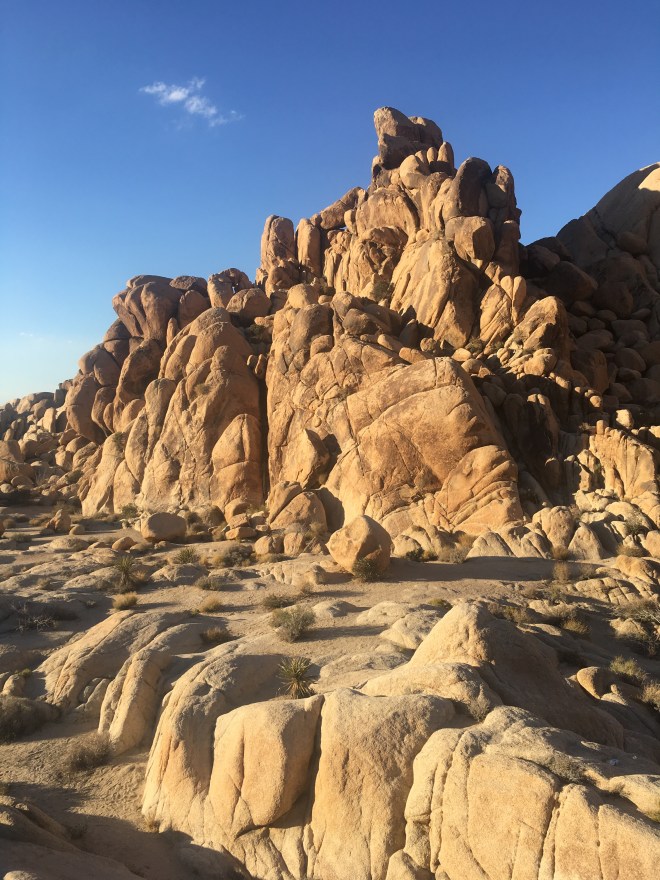
Spending the night in Joshua Tree is to be watched over by looming monzogranite rock towers. Determined rock climbers appear as mere silhouettes as they scale these majestic geologic wonders, their headlamps still shining well after sunset as they make the long way back down rock faces.
 Campsites were relatively close to each other, and we had some casual interaction with our neighbors as we ate dinner and sat around that evening’s campfire. Our site had a picnic table and fire pit, and we had plenty of space to set up our three small tents. Before darkness set in, we spent time scrambling on the rocks surrounding our campsite, keeping in mind the inevitable presence of rattle snakes and other desert dangers. As the sun began to set, my sister and I walked the Indian Cove Nature Trail, a short 0.6-mile stroll on the west side of the campground.
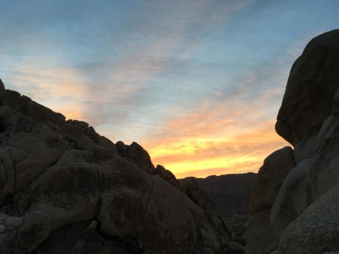
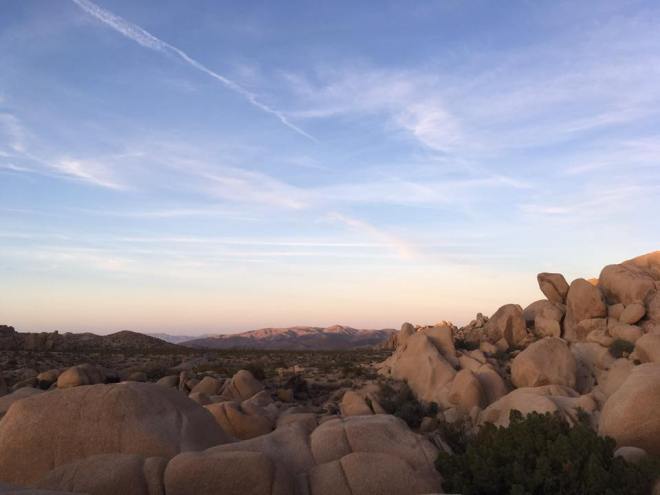
The sun’s departure causes a dramatic drop in the desert’s temperature. However, Indian Cove’s surrounding rock giants incubate the area, making for a mild and comfortable night. Unfortunately, light pollution stretching in from Twenty Nine Palms significantly reduces views of the night sky here.
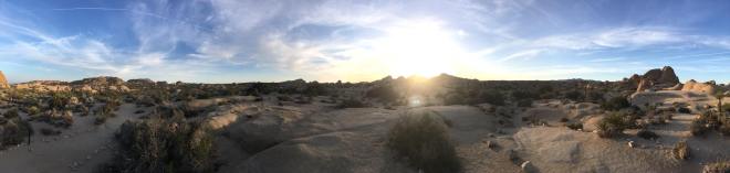
We packed up camp early the next day and made our way to the Joshua Tree National Park admission gates. To enter the park, you leave Indian Cove Campground and backtrack to Route 62. You can enter the park on the north side via the Joshua Tree Visitor Center (West Entrance Station) or the Oasis Visitor Center (North Entrance Station). Local craftsman and artists were setting up tables as we picked up maps and visitor guides at the West Entrance. There was a line to get into the park when we pulled up at 9 am but, once inside, the crowds dissipated. We could not check into our next campsite until 11 am so we headed to Ryan Mountain for our first hike of the day.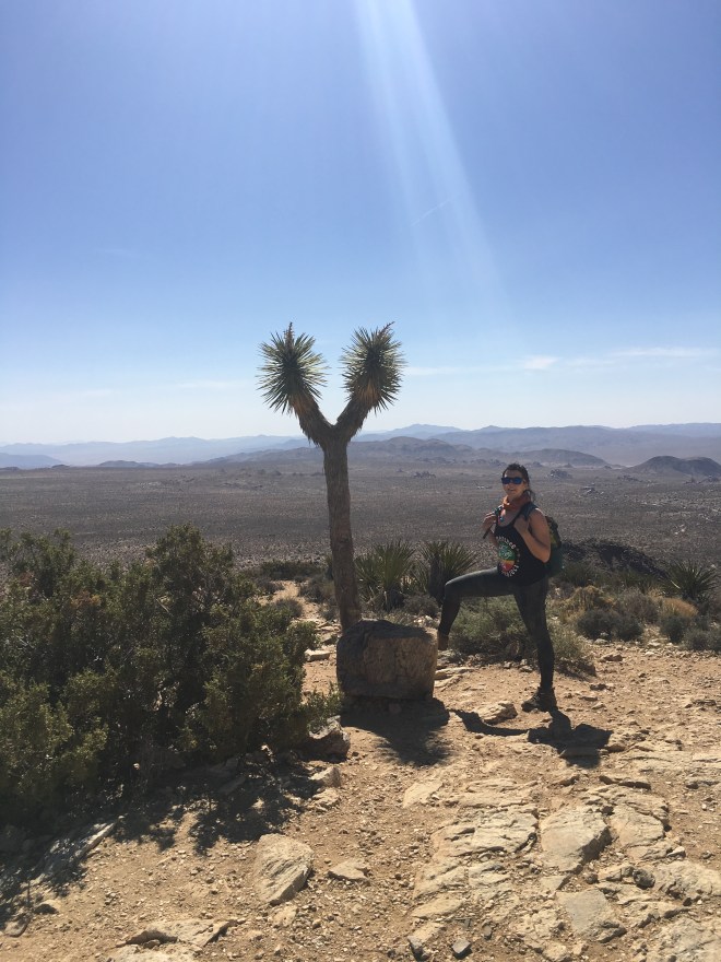
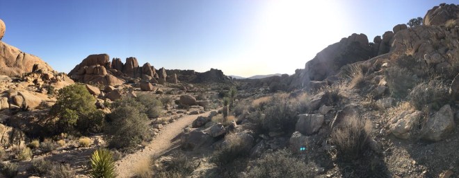
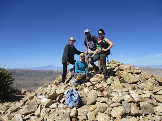
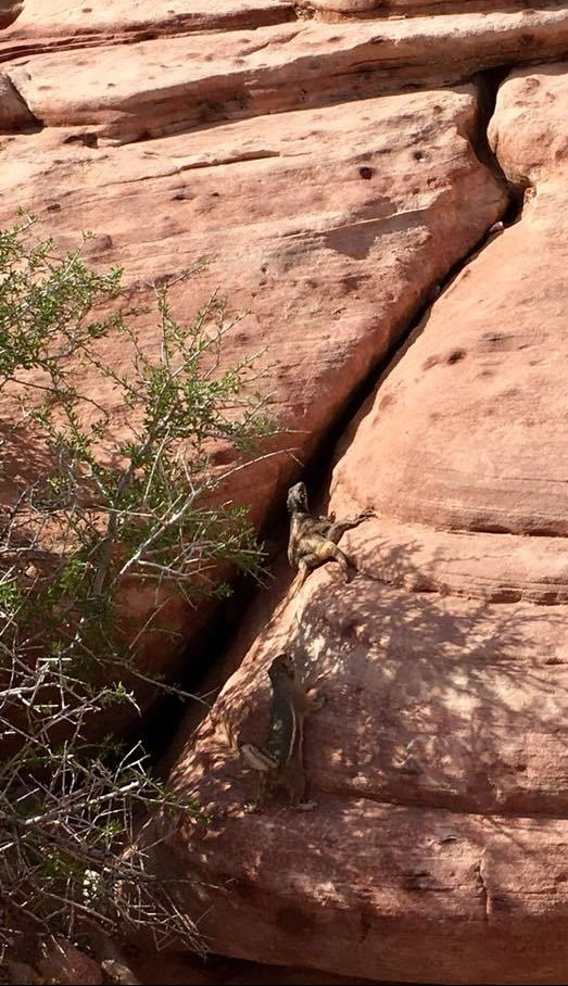
Ryan Mountain is located between the Ryan and Sheep Mountain Campgrounds and the hike is approximately 3 miles round trip. The trail is classified as “strenuous” largely due to the 1,000 feet in elevation you’ll gain during the trip to the top. However, the path is well maintained, with no required scrambling, and hikers of all ages and demographics were ascending this popular trail. There were several large Joshua Trees along the way, desert cacti blossoming, and small lizards darting from one side of the trail to the other. Views at the top were stunning, offering spectacular panoramas of the surrounding landscape. At the top, a small sign evidences the mountain’s 5457 ft altitude, while next to it a large rock pile serves as the actual high point and standard photo backdrop.
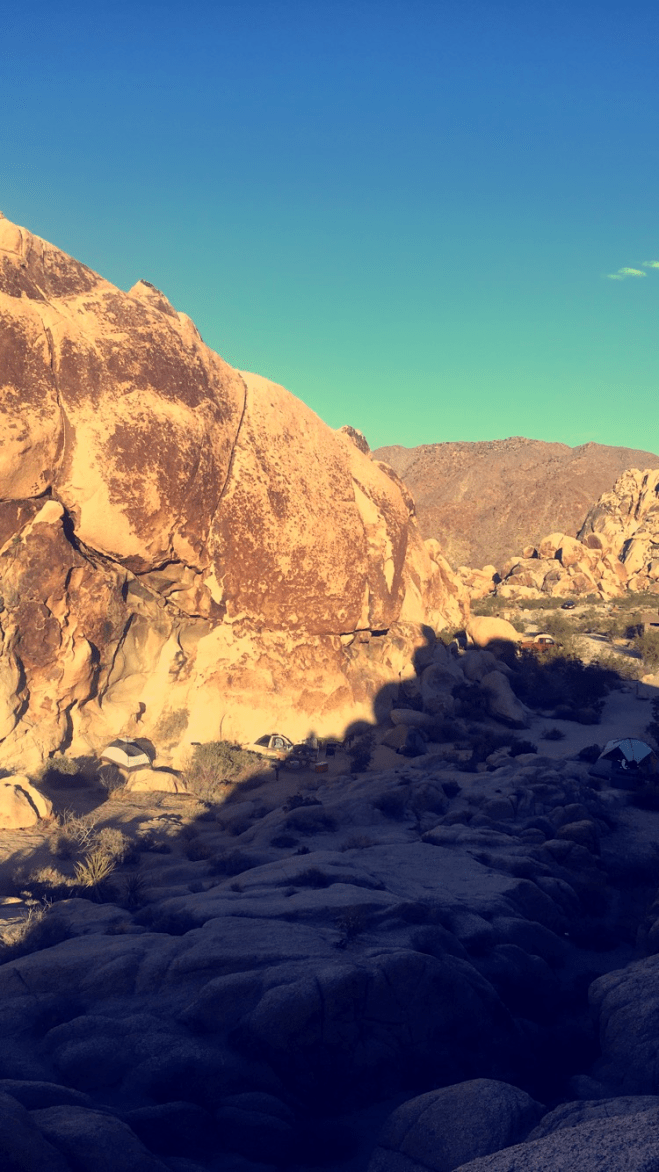
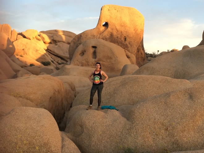
 After finishing the morning climb, we drove to Jumbo Rocks Campground to set up camp. This is an interior campground with sites reserved for $15 a night and without electricity or running water. While there are no large predators in JTNP, we were warned to put all food and toiletries in the car away from greedy rodents. Several squirrels and mice confronted us during the evening scouting for crumbs without inhibitions. Jumbo Rocks (as its name suggests) was also notable for its incredible rock formations, many named for the shapes and objects they resembled. Campsites were nestled among these rocks and several trails wound throughout leading to popular sites.
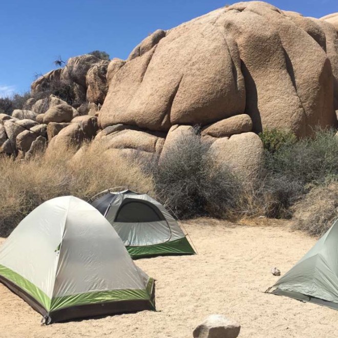
Following camp setup, we headed deeper into the park for more sightseeing and hiking, first driving to Keys View. This popular 5185 ft point is an easily accessible drive-up destination providing views of Coachella Valley, Palm Springs, San Jacinto Peak (10,800 ft), San Gorgonio Mountain (11,500 ft), and the infamous San Andreas fault. Unfortunately, the spot was also crowded, and poor air quality affected the clarity of the views.
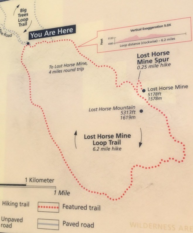
 After Keys View, we backtracked and found our way to Lost Horse Mine road, which provides a short driveway to the Lost Horse Mine trail head. This trail is popular because it travels past an old gold mining operation. The totality of the Lost Horse Loop Trail is 6.5 miles and took my sister and me about 2.5 hours to complete. There is a shorter, more popular out-and-back option that only takes you to and from the mine. I would recommend the loop option if time and stamina allows. While traveling the southern portion of the loop, you will hike through a dense Joshua Tree forest, and the light trail traffic makes for a serene and contemplative journey. The trail on the south side is mostly flat and sandy, and you do not begin gaining elevation until you round the bend and start heading back north and then west. About half way in you will begin seeing evidence of the past’s human presence – wire, fireplaces, and other metal remnants. As we headed north, the terrain changed, and we had several long, tough climbs – according to the park’s site, elevation changes over the course of the hike are approximately 550 ft. Around mile 4, we reached the famous Lost Horse mine, discovered in 1890 by rancher Johnny Lang while he searched for his lost horse. The dark, artificial structure stands out against the otherwise natural landscape braced above the trail on a hill and confined behind a chain link fence.
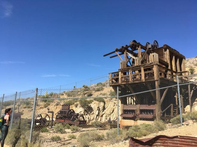

After returning to our campsite for the night, we spent some time on Skull Rock Trail, accessible from our campground. This trail brought us up close with the signature rock formations of JTNP and several hours were spent climbing up rock faces and swimming through narrow crevasses. Skull Rock itself was crowded that evening, and the failing daylight forced us to cut the hike short. Once night fell, I was disappointed to find that light pollution (likely from Palm Springs this time) extended to Jumbo Rocks Campsite and prevented the otherwise clear night sky from presenting the brilliant stars I’d anticipated.
 I undoubtedly could have spent another day or two at Joshua Tree, and the park is now securely on my “Return-to” list (next time with plans of venturing to the more remote southern and eastern parts of the park). Monday morning we woke early and after tearing down camp, stopped at Skull Rock, which was free of tourists in the early morning hours. We also drove to the Split Rock Loop Trail and walked a large portion of that 2.5-mile trail, from which we could view the appropriately-named Face Rock. As the morning matured, it signaled that it was time to head back north, through the Truffula forested Mojave back to Vegas once again.
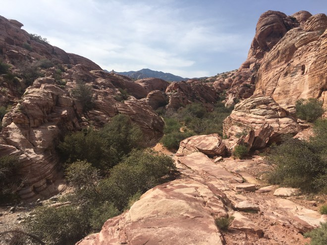
Our next destination was Red Rock Canyon National Conservation Area, existing a mere thirty minutes outside of Sin City’s glittery clutches. Red Rock Canyon with its stunning Aztec Sandstone cliffs and valleys is a paradise for sightseers, hikers, and climbers. The 13-mile paved loop within the park is renowned for the views it provides to drivers and cyclists, though I would argue a trek directly to the rocks serves as the best way to witness the colors and size of the canyon walls.
Before hiking, we first made camp at the Red Rock Canyon campground, a short 2-mile drive east on the main road (State Route 159) from the entrance and Visitor Center. Camping was first-come, first-serve, with limited spaces, and all sites were occupied by noon. Red Rock Canyon is not a park, but rather a conservation area of federal public land managed by the bureau of land management “In order to conserve, protect and enhance [the area] for the benefit and enjoyment of present and future generations…”
After paying $15 for our car’s admittance, we parked at the Visitor Center and headed to Calico Hills Trail, which offers access to the first portion of the canyon walls, known as the Calico Hills due to notably red and black patterned rocks. Depending on the path you take and the time you spend off the trail scrambling up different rocks, your adventure may take you anywhere from an hour to upwards of 4 and consist of between 2 to 6 miles of trails. While paths travel in the same direction, some wind closely to the rock walls, bringing you down into valleys, and requiring some rock scrambling, while others keep closer to the roadway and do not involve such technicality. There were also several rock enthusiasts (including free climbers) whose climbing pursuits warranted witnessing. We completed the section of trail known as Calico I and then continued north on Calico II. We arrived at the next parking area along the roadway where we accessed the trail head for Calico Tanks. While only 2.5 miles round trip, the hike to Calico Tanks was a fun adventure involving quite a bit of uneven terrain and rock scrambling. At the end of the trail you reach the “tank” – a naturally occurring water collection pit or “tinajas,” out of place in the otherwise arid environment.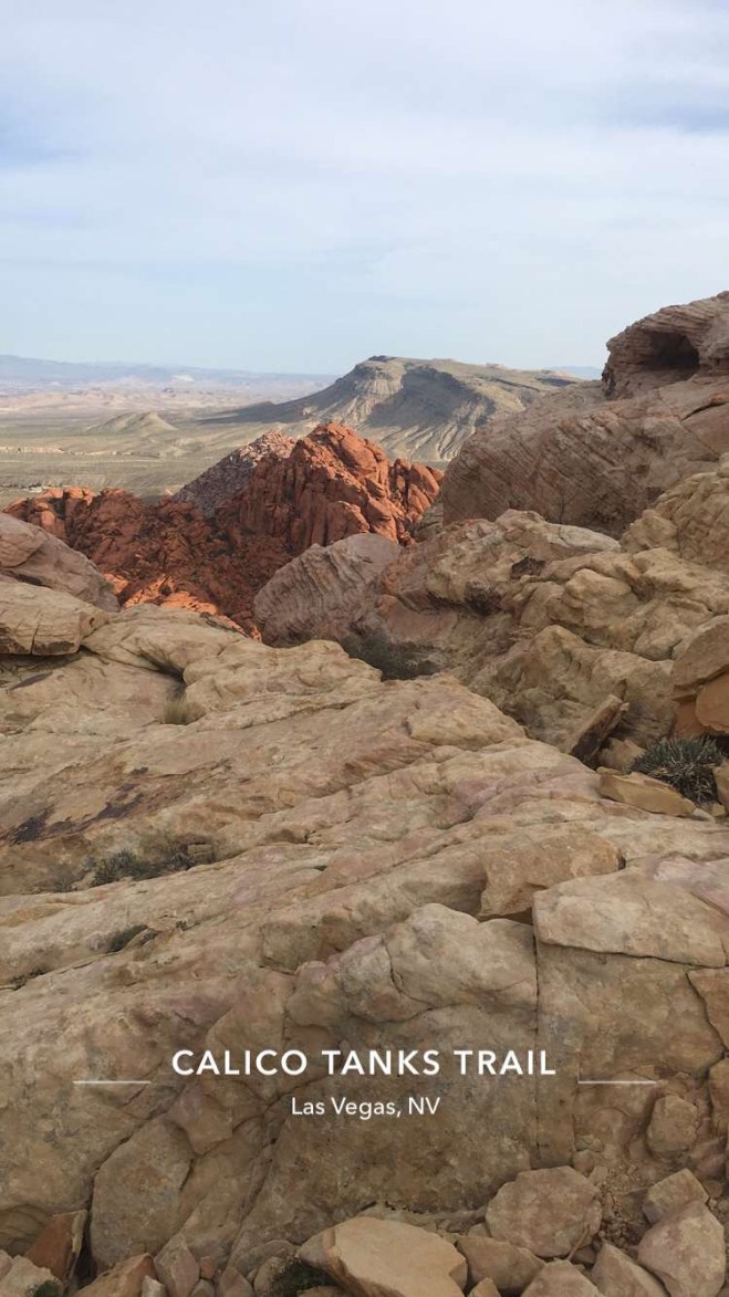
After finishing the trail, we were retrieved at the parking area, and headed back to Red Rock Canyon Campground for the night. The campground consists of entirely open space, so it was cold and windy over the course of the evening and night. Against the bright lights of Vegas, the night sky doesn’t stand much of a chance – you’ll watch the spotlight of the Luxor waving ironically as you eat your freeze-dried camping meal.
While there are plenty of other trails to take advantage of in Red Rock Canyon, we opted for relaxation the following day (we had a wedding in Vegas that night) and headed east to visit the great architectural masterpiece the Hoover Dam. The remainder of my trip was spent within Henderson and Vegas city limits, with a departure mid-afternoon on Thursday.
Any natural view can create the backdrop for an unforgettable hike, but the iconic Joshua Tree, colossal rocks, and painted canyon walls of this trip left a flavor that was uniquely and undeniably American. The desert is unforgiving, vast, dry, and at times deceptive, but within lies opportunity to see and experience an environment unlike any other on earth. More than just the landscape alone though, the roads and trails traveled are colored by historical and cultural significance, tales of gambles made and risks taken, which inevitably induce a personal ache for self-fulfillment within your own soul. So, be a frequent flier to Vegas but upon arrival, get out as fast as you can – there’s a whole desert universe to explore.
__________________________________________________________________________________________
Quick Facts:
- Length: 3 day trip
- Parks Visited
- Joshua Tree National Park
- Mojave Desert National Preserve
- Red Rock Canyon Conservation Area
- Hoover Dam
- Lodging
- Saturday: Indian Cove Campground, California
- Sunday: Jumbo Rocks Campground, California
- Monday: Red Rock Canyon Campground, Nevada
- Trails
- Indian Cove Nature Trail – 0.6 mile loop (30 minutes approx..)
- Ryan Mountain – 3-mile out-and-back (2.5 hours)
- Lost Horse Loop – 6-mile loop (2.5 hours)
- Skull Rock Loop – 1.7-mile loop (1.5 hours)
- Split Rock Loop – 2.5 mile loop *did not complete entirety (1.5 hours)
- Calico Hills I and II – 4ish miles? (3 hours)
- Calico Tanks Trail – 2.5-mile out-and-back (2 hours)
__
Citations:
